
THE GASPE PENINSULA, CANADA
On the warmest summer day, wildflowers sway and hayfields ripple in the cool, brisk breeze that rises off the St. Lawrence Estuary. The easy warmth of sun-drenched meadows framed by the ever-present sea belie the harshness of wintry days when snow covers the ground and ice floes threaten ships making their way up the mighty river. Here, the
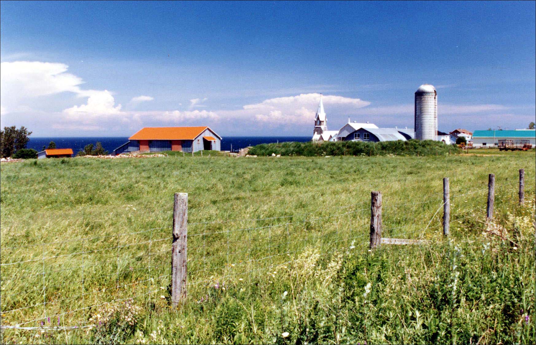 |
North Coast Farm |
The Gaspesian Mi'kmaq are sometimes called 'the Indians of the Sea' and were noted for their fishing skills and their distinctive birch bark canoes that were capable of crossing open water. During the summer months, they resided in coastal villages where they fished for cod and collected shellfish. They also gathered nuts and berries and some may have cultivated basic crops but generally, the climate was too inconsistent for organized agriculture. In the fall, they moved inland to scattered camps to hunt moose, beaver, caribou and bear which, along with other stored food supplies, tided them through the coldest winter months. Spring was the time for collecting maple sap and moving back to the coastal villages to fish the rivers for salmon and sturgeon.
They were the first documented Native Americans in the area to make contact with Europeans. When Jacques Cartier sailed into the Baie de Gaspé in 1534, he was greeted by Mi'kmaq waving beaver furs and speaking in pidgin Basque. They were clearly accustomed to trading with Europeans. It is not certain when initial contact actually took place but it is thought that John Cabot's description in 1497 of 'new found landes' and a sea swarming with fish brought Basque fishermen to these waters early in the 16th century. Norse Vikings are known to have established a settlement in Newfoundland around 1000 AD and may even have ventured to nearby Gaspesie but little is known about these early explorers or the people they encountered.
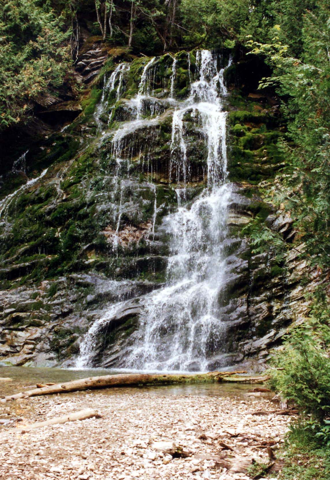 |
La Chute |
The Basques established a summer whaling station in Labrador in 1527 but no permanent settlements were made. By 1580, around 10,000 European fishermen were making the trans-Atlantic voyage to the area each year mainly to fish for cod. They used two methods for preserving their catch. Green fishery involved the cleaning and salting of fish aboard the ship. Southwest French fishermen who had inexpensive access to vast amounts of sea salt preferred this method. Green or salted cod sold for less than dried cod but the speed of processing allowed the ships to make two fishing trips in one season. Dry fishery was a lengthier procedure necessitating coastal bases where the cod could be cleaned and dried. Besides the higher market price for dried cod, additional revenues were generated by the extraction of cod liver oil which was a source of fuel for lamps and lubricants for machines. This process directly impacted local peoples. In Gaspesie, the Mi'kmaq assisted the Europeans and were able to exchange labor and furs for metal tools but the Laurentian Iroquois of Gaspe Bay who Cartier also encountered in 1534 were subjected to European encroachment upon their fishing territories and loss of their land to the Mi'kmaq sometime during the 16th century.
The furs taken by these early fishermen created a great demand for North American beaver pelts in Europe. By the end of the 16th century, French fur traders were regular visitors to the area but it was not until 1608, after several failed attempts, that Samuel de Champlain founded the first permanent French settlement at the site now known as Quebec City. It remained a small community for years due to the paucity of French immigrants. Unable to secure New France's territorial claims with colonists, Champlain sought to extend French influence among native populations and in 1615, he persuaded four Recollets from the monastery in his hometown of Brouage to accompany him to Quebec.
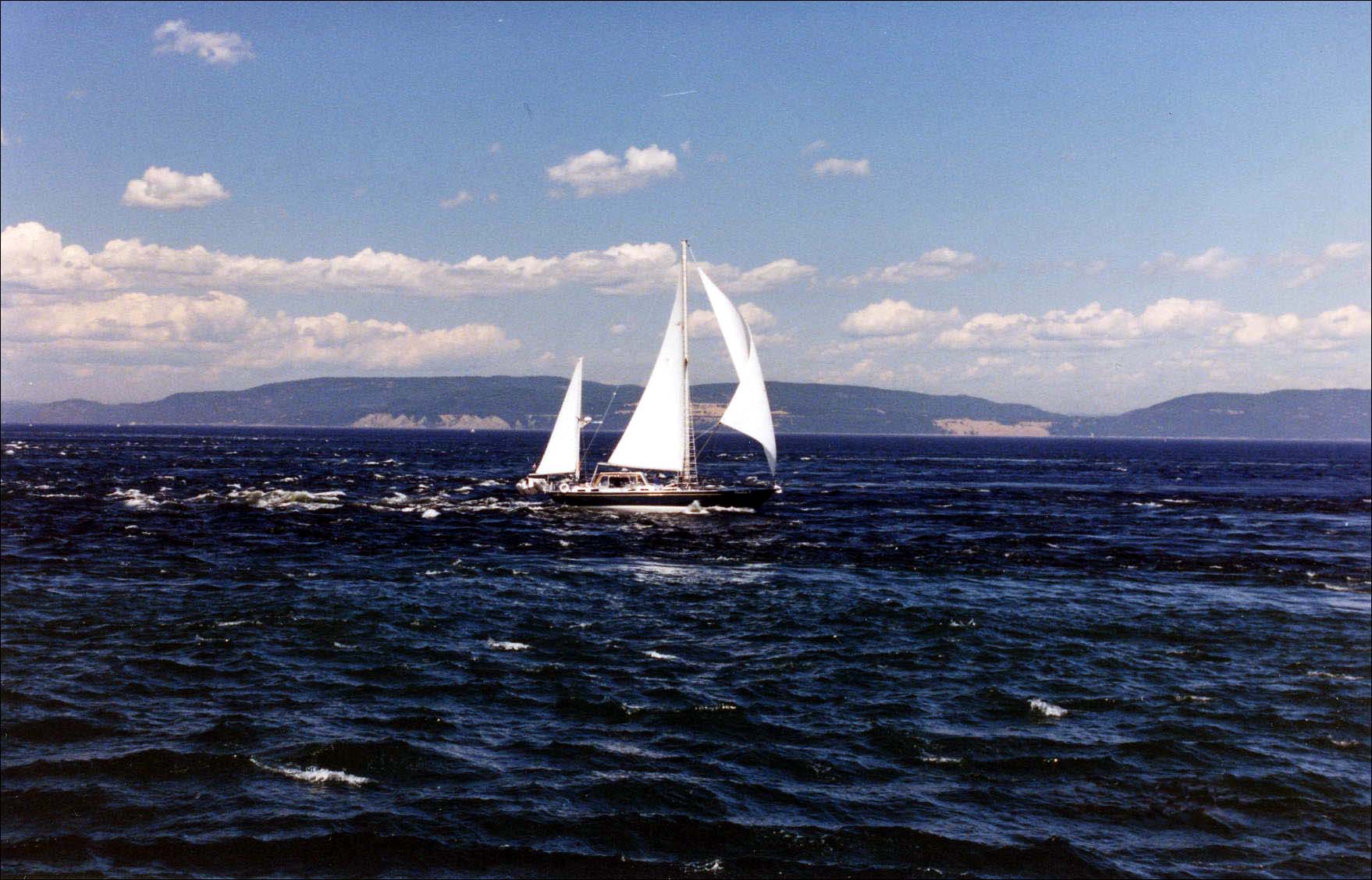 |
Whalewatching |
The harsh winters and shallow soils of Gaspesie deterred early settlers and even today, it remains sparsely populated. The first European settlers in this region were fishermen who may have married local women. Later, with immigration actively supported by the French Crown, seigneuries or land grants were made with the obligation of preparing the land for new immigrants and agriculture. Unlike the populous English colonies, there were only about thirty five hundred French settlers in all of Canada by 1666 and they mainly occupied the St. Lawrence Valley and Acadia (Nova Scotia and New Brunswick). Richard Denys, Sieur de Fronsac, inherited a seigneury that encompassed land bordering most of Chaleur Bay extending from Perce in Gaspesie to Nipisiguit, (Bathurst, New Brunswick). In 1671, he invited two Recollets to set up missions for about one hundred settlers as well as the summertime population of four to five hundred European fishermen and the numerous Mi'kmaq who worked with them. Father Chrestien Le Clercq, another Recollet missionary, arrived in 1676 and stayed for almost a decade. Much of the early information about this area comes from his book, Relation de la Gaspesie, that was published in Paris in 1691. The region's oldest missions were established in Perce and Restigouche (near Pointe-a-la-Croix), two of the largest fishing communities at that time. These temporary settlements evolved into permanent fishing villages such as the Bourg de Pabos, whose register dates back to 1751. It has been excavated and today, the on-site museum provides an interesting look at an 18th century Gaspesie fishing village.
 |
Indian Head Rock |
The ongoing struggle between the English and the French for North America expressed itself locally in the dispute over the region known as Acadia. This territory, stretching from Maine to New Brunswick, changed hands several times during the course of the 17th century. After Queen Anne's War, it passed permanently to the English in 1713 by the Treaty of Utrecht although France kept Cape Breton and retained control of the New Brunswick area. It was a tentative peace because the English felt threatened by the French-speaking Acadians who outnumbered them considerably. Even though the Acadians claimed neutrality, the English expelled those who would not pledge allegiance to the English Crown in 1755. Many were forcibly deported to various locales while others ran away to French Acadia (New Brunswick) where they joined the Mi'kmaq in resisting the English.
By 1756, the English and French were at war again. The English captured the French fortress at Louisbourg on Cape Breton in 1758 enabling them to establish a blockade of the Gulf of St. Lawrence. They monitored the coastal waters from Cape Breton to the Gaspe Peninsula where they attacked French ships and demolished many of the French fishing villages including the Bourg de Pabos. Gaspesian and Acadian fishermen fled to the fortified town of Petite-Rochelle at the mouth of the Matapedia River. In 1760, a fleet of three French ships with supplies and reinforcements for Quebec reached the Gulf of St. Lawrence but was diverted to Chaleur Bay by the English patrols. The Acadians at Petite-Rochelle were able to unload the food and ammunition before the English engaged the French fleet in the last naval battle of the war between France and England. The French ships and the fort were destroyed and Quebec, lacking the reinforcements needed, fell for the last time to the English.
After the destruction of Petite-Rochelle and the departure of the English ships, Acadian families settled on the Gaspesie shore of Chaleur Bay, an area of beautiful beaches and sheltered bays where numerous rivers flow from wooded hills to the coastal plain. Still wary of the English, an early Acadian community was established at the mouth of the Bonaventure River because their ships could anchor in the natural, deepwater harbor without being seen from the sea. They constructed their homes in the woods near to their farms and also built seaside cabins for summer fishing. Other Acadian communities were founded at Tracadigache (Carleton), Cascapedia (New Richmond) and Paspebiac where they farmed, fished and established a logging industry based on the demand for red pine masts in Europe and the Caribbean.
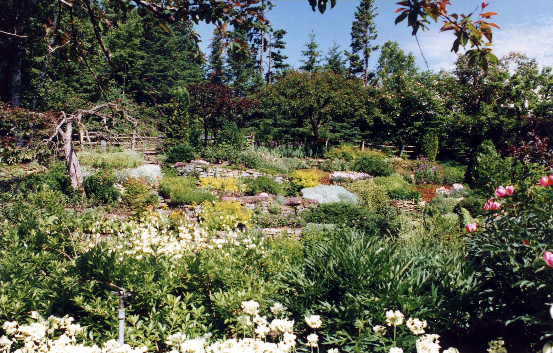 |
Reford Gardens |
Fishermen from the Channel Islands were among the earliest Europeans to visit North American offshore waters. Some believe that they crossed the Atlantic long before Columbus' voyages and that it was on their recommendation that Cabot sailed for Newfoundland in 1497. By the end of the 17th century, Jersey merchants had established a lucrative triangular trade between New England/Newfoundland, the Caribbean and Europe. Today, salted cod from Canada remains the basis of many Caribbean dishes in spite of easy access to local seafood. Charles Robin, a Jersey merchant, set up a fishing post at Paspebiac in 1767 after Canada passed to the English. However, Canadian fishing posts were targeted by American corsairs at the onset of the American Revolution and Robin was forced back to Jersey when his store was destroyed and his ships captured in 1777. Six years later, the conflict between the English and the Americans was resolved and Robin returned to Paspebiac where the lack of competition allowed him to establish a cod fishing monopoly that extended to New Brunswick and Cape Breton. Other fishing posts were set up along the Gaspe coast and the Charles Robin Co. was instrumental in bringing Jersey families to settle at Paspebiac, Port Daniel, Grande-Riviere, Perce, Gaspe and Grande-Grave.
Coinciding with Charles Robin's return to Gaspesie was the influx of Loyalists from the American colonies. Although some had fled at the beginning of the Revolutionary War, the greatest Loyalist immigration to Canada took place after the war ended in 1783. Loyalist groups established farming communities at New Carlisle, New Richmond and Douglastown. They were joined by waves of new immigrants in the 1840s when potato crops failed in Ireland and Scotland. Early Gaspesians were geographically and culturally isolated and up until the turn of the 20th century, a hodgepodge of accents, languages and customs characterized the peninsula.
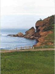
The spine of the Appalachian Ridge separates the northern shore from the southern shore and the Matapedia Valley dislocates the peninsula itself from the rest of Quebec. The sea was the only practical means of transportation until the first roads were built in 1858 and even then, the coastal road around the peninsula was not completed until the 1920s. Both the Mi'kmaq and the earliest settlers favored the southern coast along Chaleur Bay. The entire bay is a part of the Gulf of St. Lawrence in an area known as the Magdalen Shallows. Here, the Gaspe Current brings temperate freshwater from the St. Lawrence River to a shallow shelf producing the warmest oceanic waters in Eastern Canada. Sweeping bays, sandbars and red cliffs dominate this shoreline. The northern coast is more rugged. To the east of Matane, the winding road clings to the base of forested hills with bold cliffs and outcrops of tumbling scree. Swift rivers flow to sheltered coves with small fishing villages. These rivers offer some of the best salmon fishing in the world and gave rise to tourism in Gaspesie late in the 19th century. Northern coastal towns are smaller and farther apart than those on the south coast. Each town possesses its own beautiful stone church that must have provided security and stability to people facing the precariousness of a life at sea. In the summer months, when garden plots flourish and newly washed laundry flap in the salt-tinged breeze, huge woodpiles serve as a reminder of the harshness of winter when roofs of vibrant orange, purple, sea green and magenta brighten the dreary days and shout their defiance of the cold, the wind and the sea.
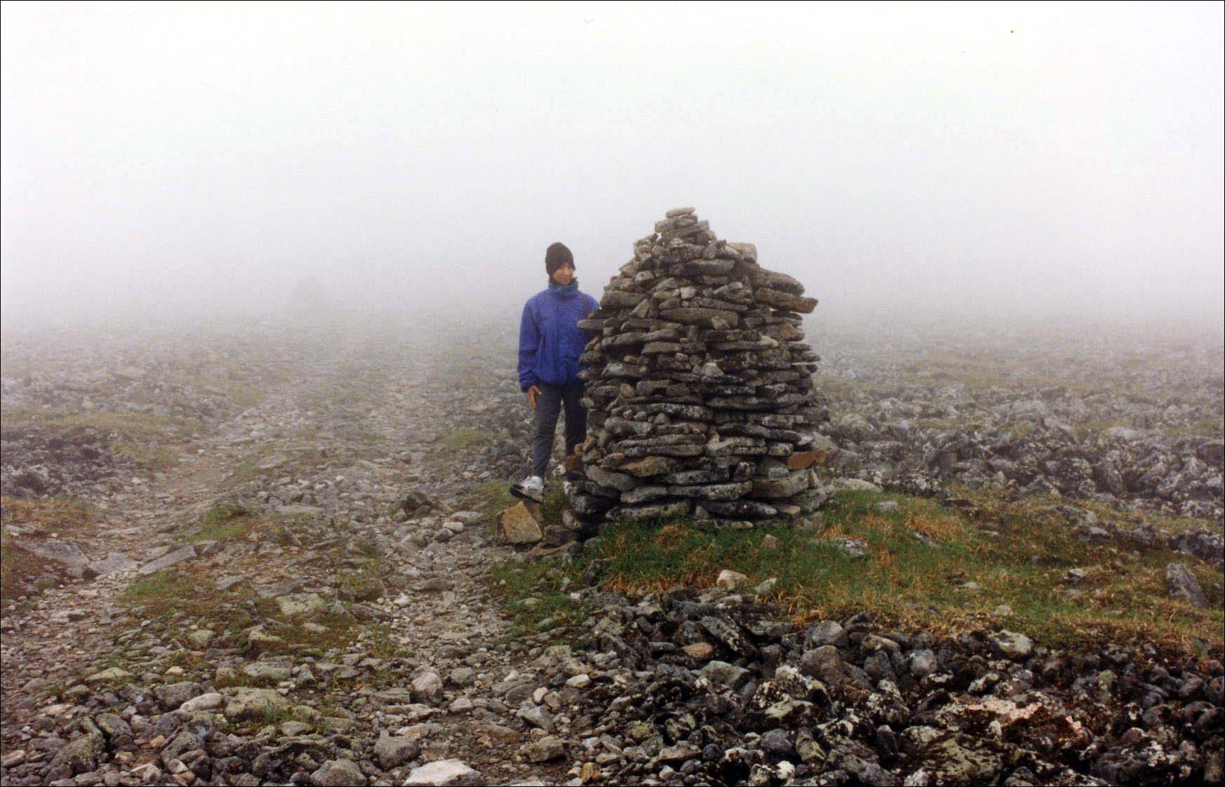 |
Trailmarker, Mt. Jacques Cartier |
Rich in cultural history, the wide open spaces of the Gaspe Peninsula are a nature lover's dream. Exquisite landscapes and seascapes, boreal forests, pristine rivers, a vast array of wildlife and some of the oldest fossils in North America can all be found here. Most of these treasures are best discovered on foot or from the water. The Parc de la Gaspesie has over 60 miles (100 km) of scenic hiking trails within the Chic Chocs range and the Monts McGerrigle massif which are separated by the Ste-Anne River. Trails traverse the width of the park with side trails to several peaks. It is on these peak ascents that the drama of the park's unique vegetation and wildlife unfolds. White tailed deer live in the mixed forests of yellow birch, poplar and balsam fir that grow at the lowest levels along the river valleys. Here, too, wild strawberries and a variety of berry bushes flourish in an ambient zone that allows public berry picking. These mixed forests give way to boreal forests of spruce, balsam fir and white birch. Moose are abundant but in the early summer, cows are protective of their gangly, newborn calves. Further up is a sub-alpine zone of black spruce forests. These trees become stunted and twisted as they approach the treeless tundra where small arctic bushes and mosses take over. Woodland caribou graze on lichen on the highest peaks of Mt. Jacques Cartier (1268m), Mt. Albert (1154m) and Mt. Logan (1128m). The Chic Chocs are more extensive than the McGerrigles and the best backcountry trails are found here. Several day hikes and nature walks can be undertaken from the Lake Cascapedia area. The highest peaks in the Chic Chocs are Mt. Albert and Mt. Logan. The trailhead for the full day loop to the top of Mt. Albert is located near to the Interpretation Center but a return trip to Mt. Logan entails a 3-5 day trek. Most of the trails within the McGerrigles fall within a preservation zone that demands special care of the fragile environment. Mt. Jacques Cartier is the highest peak of the McGerrigle Massif and the entire park. Park buses shunt hikers from the Interpretation Center (Route 299) and La Galene parking lot (Route 2) to the trailhead for a 3-4 hr. hike to the top and back.
The trails of the Forillon National Park are noted for their breathtaking seascapes, especially the path to the lighthouse at the tip of Cap Gaspe. Another interesting trail is Le Portage (11km) which was cut to give the farmers and woodcutters of L'Anse-au-Griffon access to Gaspe Bay. This park is considerably smaller than the Parc de la Gaspesie and most trails take only a few hours to hike. However, hiking trails are not limited to parks. On the peninsula, every town has its own special places. Two towns with very scenic paths are Mont-Saint-Pierre and Perce. The unpaved road to the top of Mont-Saint-Pierre offers a panoramic view of the town nestled in the valley of the Mont-Saint-Pierre River. This is one of the premier hang gliding locations in North America and in the summertime, especially during La Fete du Vol Libre that takes place at the end of July, brilliant colors fill the air as 'birdmen' swoop and glide to the meadow below. There is a lengthier but very beautiful mountain trail that follows the river all the way to the Parc de la Gaspesie (about 27 km). It passes by Lac Lemieux, a convenient place to camp with the possibility of observing moose at the water's edge.
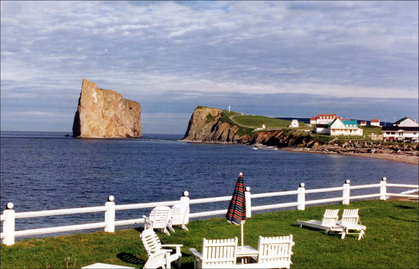 |
Perce Rock |
Perce, too, has some excellent trails. The most popular is the path to Mont-Sainte-Anne that starts behind Saint-Michel Catholic Church. After about 3/4 km, the road forks. The left fork leads to Mont-Sainte-Anne which commands superb views of Perce Rock, Bonaventure Island and the surrounding coastline. The right fork is an easier trail to a pretty waterfall at La Grotte. Other options include the trail to La Crevasse, the path from Route 132 to Cap Barre and the walk to Perce Rock at low tide that begins at the parking lot on Mont-Joli. This Pierced (Perce) Rock is an impressive monolith that is perhaps the most photographed locale on the Gaspe peninsula. However, its name is attributed to prior 'holes in the wall' whose arches have collapsed over time. In the early 19th century, villagers climbed to its summit to collect an annual harvest of about three tons of hay but climbing the rock was prohibited after one man lost his life. Today, seabirds make their nests on the summit.
In 1604, Samuel de Champlain wrote of Canada's Atlantic coast: 'The abundance of birds of different kinds is so great that no one would believe it possible unless he had seen it.' This spectacle is now limited to remote Atlantic islets as well as Bonaventure Island where over 200,000 birds nest in an area of only 416 sq.km. off the Perce coast. Of these, about 50,000 birds form the largest gannet colony in North America. Other seabirds include Leach's storm petrel, herring gull, black legged kittiwake, common murre, black guillemot and the razorbill, many of which can also be seen on nearby Perce Rock. A boatride to Bonaventure Island allows some interesting walks among wildflower meadows to the cliffs overlooking the gannet colony. There are outstanding views of the mainland but this is not a peaceful walk due to screeching birds and pungent odors. Generally, the best birding sites in Gaspesie range from Cape Bon Ami in Forillon Park to the New Brunswick border. Brackish waters, where rivers meet the sea, as well as sandbars, attract great numbers of shorebirds. Two favorite sandbars for bird watching are located at Barachois, just north of Perce, and Carleton. Shorebirds can also be seen on the northern coast in the saltwater marsh located at the Baie-de-Capucins.
Several parks and reserves protect the diverse habitats of the Gaspe Peninsula and are responsible for the richness of its wildlife. The Parc de la Gaspesie marks North America's most southerly range of the woodland caribou. It is also the only place on the continent where white tailed deer, moose and caribou live together and one of the few places in the world where boreal forests and tundra occupy the same region. Caribou are unlikely to be seen without hiking to Mont Albert or Mont Jacques Cartier but moose can be easily viewed from the lookout tower along Route 11 at Lac Paul. Most of the park falls within the boreal forest life zone that is characterized by 'muskeg,' a waterlogged peatland that provides food and shelter for ducks, geese, numerous species of migratory birds and other woodland creatures such as lynx and the snowshoe hare. Fortunate bird lovers may spot the majestic golden eagle. Another notable visitor to this park is the beautiful Harlequin Duck (Histrionicus histrionicus), a sea duck that usually lives on the cliffs of Forillon and Perce/Bonaventure Island and are often seen bobbing in the surf. In the summer months, they make their nests among the rapids of the Ste-Anne River in the Parc de la Gaspesie. Unfortunately, the Eastern North American population is currently endangered and only about a thousand Harlequins remain.
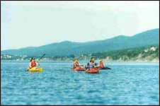
The Forillon National Park is also replete with wildlife. The black bear, red fox, moose, lynx, beaver, coyote, mink, ermine and other small forest animals are found here. Land birds are plentiful with 26 raptor species visiting this park. Graceful, black-legged kittiwakes return at springtime to nest in the cliffs of Cap Bon Ami where they were born. They are lured, like other seabirds such as gulls, black guillemots, razorbills and double crested cormorants, to the surrounding waters that provide a rich supply of food for thousands of these nesting birds as well as whales, porpoises, dolphins and seals. Whales may sometimes be viewed from the cliffs of Forillon but they are more easily seen on whale watching cruises or on sea-kayak trips, both of which depart from the Grande-Grave area of the park. Forillon's sea-kayak tours combine dramatic scenery and a variety of sea creatures to provide some of the best sea-kayaking experiences in Eastern North America. Cetaceans found in Gaspe Bay include Blue, Fin, Humpback and Minke whales, the Pilot whale, white-sided dolphin and the harbor porpoise. Occasionally, sperm and killer whales are seen. The North Atlantic Right Whale has been hunted almost to extinction with only about 250 animals remaining so whale watchers are particularly enthused when they see one.
These whales also visit the Strait of Honguedo (between Gaspe and Anticosti Island) and the St. Lawrence Estuary where there is, additionally, a resident population of beluga whales. Beluga is a corruption of the Russian word belukha meaning 'white' which commonly describes Delphinapterus leucas or 'white dolphin without a wing.' They are cold water, toothed whales that traditionally live in Arctic waters. Although Arctic belugas migrate over great distances, the St. Lawrence belugas only travel the length of the estuary and the widest parts of the river. They are often observed in the area of the Saguenay Marine Park and are a favorite among whale watchers because of their expressive faces and spyhopping habit of swimming with their heads held high out of the water. Whale watching tour operators are forbidden to approach belugas but their distinctive white color is easily spotted from a distance. There were once thousands of St. Lawrence belugas. Native people showed Jacques Cartier how to capture them by means of a sapling fence placed in the off-shore mud at low tide but it wasn't until the late 19th and early 20th centuries that they were hunted almost to extinction. Today, their population has stabilized at around 500 but scientists remain concerned that their numbers have not been growing and they are classified as an endangered population. There is evidence that pollution is affecting them adversely and it becomes ironic that early whalers called them 'sea canaries.' This was due to the clicks and whistles that they emit but perhaps they now serve to warn us in the same way that miners use canaries to detect danger.
BEST TIMES TO GO:
The Gaspe is accessible year round. Spring, summer and fall are excellent for hiking while winter attracts cross country skiers. The best month for hiking is October due to fall colors and clear, brisk weather. Although May to October is the traditional whale watching season, the most productive time is from June to July when they pass close to shore and can be seen along the Gaspe coast from Ste-Flavie to Perce. Sea kayaking among the whales is especially rewarding during this period but the sport can still be enjoyed in the remaining summer months. Bird watching is best at springtime on the Gaspe peninsula which is located within the Atlantic flyway. Many seabirds nest at Forillon National Park and Bonaventure Island during the summer months and the fall migration is also worthwhile.GETTING THERE:
Exploring the Gaspe peninsula is easiest by car. From Quebec City, the region is reached along the southern shore of the St. Lawrence by Highway 132. At Ste-Flavie, there is the option of continuing around the peninsula or crossing the Matapedia Valley to reach the southern Gaspesie shore. The area can also be reached via Highway 11, the coastal road from New Brunswick.Matane, on the north shore, is served by ferries from Godbout and Baie-Comeau. A ferry links Nouvelle-Ouest on the south shore to Dalhousie, New Brunswick. Domestic airports are located at Mont-Joli, Gaspe and Bonaventure with connections to Montreal, Quebec City and Toronto provided by Inter-Canadien and Air Alliance. VIA Rail's Montreal to Gaspe route travels through Levis (Quebec City), Rimouski, Mont-Joli, Matapedia, Bonaventure and Perce. Bus service from Quebec City and Cambellton, New Brunswick is available to Matane and supplemented with local bus routes from Matane to Gaspe and Gaspe to Cambellton.
CLOTHING/GEAR:
Clothing should be season-appropriate. Springtime in Gaspesie is short due to its late arrival in May. Summer weather is variable and the mildness of the summer day is often determined by the direction of the wind. Westerlies bring clear, mild continental air while easterlies, blowing off the Labrador Current, bring cold, rainy weather. Since these winds can change directions quickly, hikers and those planning to spend some time on the water should always pack waterproof and windproof outerwear. Sturdy, waterproof hiking boots make peak ascents safer because trails are rocky and very slippery when wet. Bird and whale enthusiasts should remember to pack binoculars. A daypack, picnic lunch, water bottle, compass, first aid kit and insect repellent are suggested for most day excursions. Neoprene suits and life vests are included when renting equipment from sea-kayak and canoe outfitters.GENERAL INFORMATION:
Permanent tourist information centers are located along Highway 132 in Ste-Flavie (tel. 418-775-2223, 800-463-0323) and Matane (tel. 418-562-1065). Seasonal (mid-June to early September) information centers are located in all the main towns. These are excellent sources of maps, brochures and general information in English and French. They will also help to find suitable lodging. Tourism Quebec produces a helpful tourist guide to the Gaspesie region. It is available at local and Quebec information centers or it may be requested by contacting: Tourisme Quebec, PO Box 979, Montreal, PQ, Canada H3C 2W3, Tel. 514-873-2015.Many small town hotels are modest and owner-operated. On the northern coast, travelers should begin to look for accommodations early in the afternoon or make advanced reservations due to the distances between towns. Park accommodations are very popular and during the summer months, it is imperative that reservations be made at least 3 days in advance. Both park and private campgrounds are plentiful. Other options for lodging include Cegep facilities (college dormitories) for low budget travelers and a varied selection of 'gites' to suit any budget, some of which are quite elegant. In the winter months, many places are closed so advanced reservations should be made before embarking on a trip to the region.
Mi'kmaq communities on reserve lands are located at Listuguj (also known as Restigouche) near the mouth of the Matapedia River, and Gesgapegiag (also known as Maria) at the mouth of the Cascapedia River. Both rivers flow into Chaleur Bay. Other Mi'kmaq communities outside reserve lands are found near Gaspe Bay at Saint-Majorique, Pointe Navarre and Gaspe. They are dependent on the tourist industry which provides jobs as fishing guides and an outlet for their handicrafts. During the summer months, both reserves and a Mi'kmaq Historic Village in Fontenelle (Saint-Majorique) invite the public to become acquainted with Mi'kmaq culture through Interpretation Centers and participatory activities. Other cultural centers and museums are found in major towns. These include the Gaspesian British Heritage Center in New Richmond, the Acadian Museum of Quebec in Bonaventure and an exhibit of a small Channel Islands fishing village at Grande-Grave in the Forillon National Park.
PLANNING TIPS:
IMPORTANT RESOURCES:
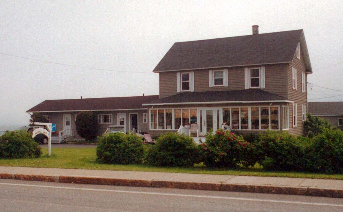
Perce, PQ Canada G0C 2L0
Tel. & Fax: (418) 782-2330
Toll Free: (888) 467-3723
Email: info@hotelperce.com
Hotel-Motel Rocher Perce is situated across from the Perce Rock with direct beach access at low tide. Its unique location affords one of the most beautiful views in all of Gaspesie and is a convenient base for visiting Forillon National Park. This modest but charming establishment offers a choice of lodging that includes hotel rooms, kitchenette units and a chalet. The price of a double room with continental breakfast begins at about C$60 per night. A variety of packages with tours and dinner added are also available. The facility is open to the public from springtime to the fall months and a tea room serves coffee, tisanes and tea.
Proprietor, Madeleine Pidgeon extends personal service and shares her love of art, music and adventure travel. She speaks English and French and will help her guests to make arrangements for a variety of Gaspesie excursions. She also provides helpful information about hiking on the peninsula.
Croisieres Baie de Gaspe offers exciting 2 1/2 hr. whale watching cruises from June to September at 9:30 a.m. Afternoon cruises are also scheduled for July and August. Cruises begin at Grande-Grave in the Forillon National Park where the dramatic, eastern tip of the Appalachian Mountain Range can be seen. A bilingual naturalist/guide provides an insightful look at a variety of cetaceans including the Blue, Fin, Humpback and Minke whales, the Pilot whale, white-sided dolphin and the harbor porpoise. Passengers can listen to their songs by means of an on-board hydrophone and learn to discern the species of a whale by its blow. Advance reservations are suggested.
Carrefour Aventure offers a wide range of outdoor activities that include tandem hang gliding flights and sea-kayak, mountain bike and hiking tours. In June, there is a good chance of kayaking among whales that pass close to the shore. Guided hikes can be arranged in the nearby Parc de la Gaspesie and along trails that lead to the park from Mont-St-Pierre.
Cime Aventure, from the Grande-Grave office in the Forillon National Park, offers some of the most exciting sea-kayaking trips available in Eastern North America. Breathtaking scenery, seal rookeries, thousands of nesting seabirds and the magnificence of breaching whales elicit memories that last a lifetime. In addition to daily tours, Cime Aventure organizes 6-day 'Discover the Wildlife in Forillon' excursions in the months of June and September. These tours include kayaking, cycling and walking.
The Bonaventure office offers a variety of canoe trips that last from a few hours to 6 days on the Bonaventure River. All Cime Aventure tours include basic instruction in paddling techniques and safety tips as well as the equipment needed to enjoy these activities. Sea-kayaks and canoes may also be rented independently with shuttle service provided.
Sepaq develops and operates tourist facilities within the parks of Quebec. These include campgrounds, resorts and wildlife reserves. One of its resort facilities, Gite du Mont-Albert in the Parc de la Gaspesie, is a school for chefs and is noted for its excellent cuisine at reasonable prices. Its popularity requires advance reservations for the restaurant and/or accommodations.
RELATED BOOKS:

Adventures Great and Small © copyright 1996-2005