
A BRIEF HISTORY OF CANADA
A BRIEF HISTORY OF CANADA
From its northern Arctic islands to the majestic mountains of the Western Cordillera and the windswept tip of Newfoundland, Canada encompasses an area of almost 4 million square miles (10 million square kilometers). It is the largest country in North America but its entire population of approximately 30 million is equivalent to that of California. Most people reside close to the US border and the vast expanse of remaining land forms one of the most extensive wilderness areas in the world.
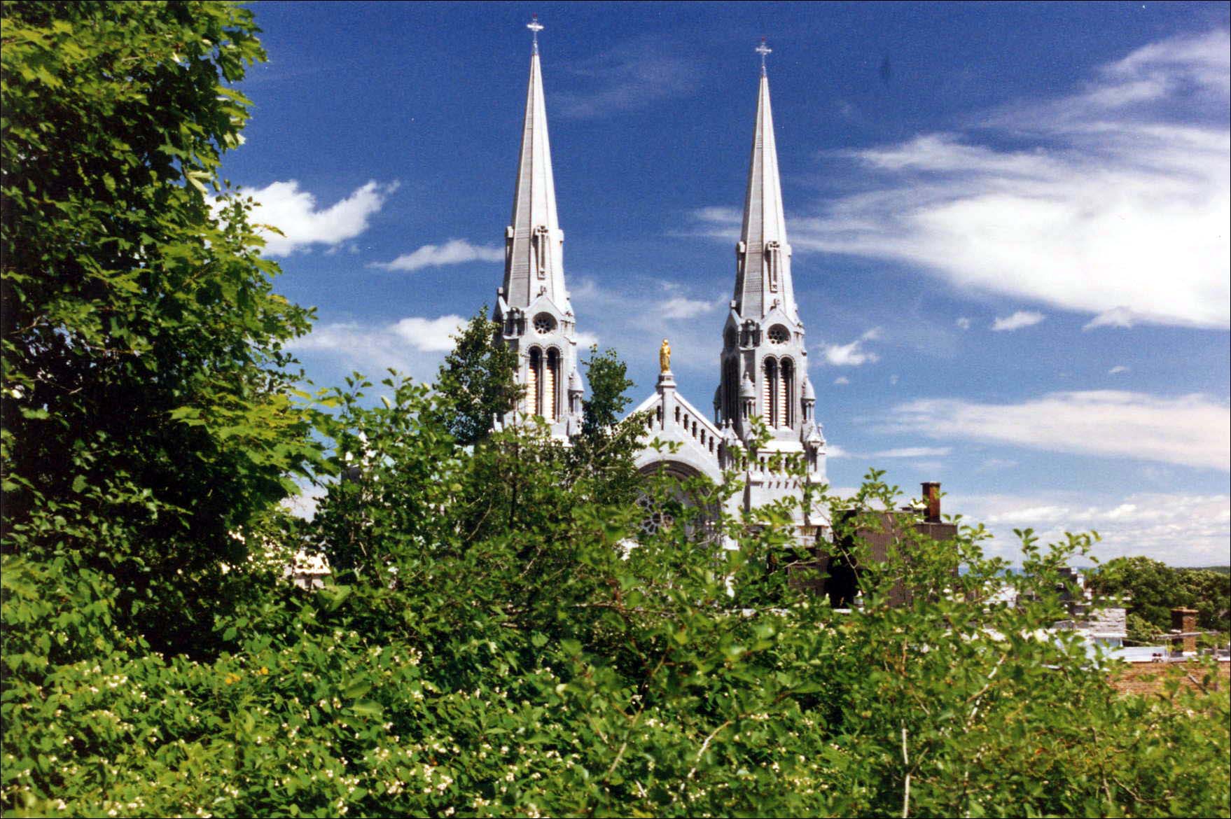 |
Basilica at Ste. Anne de Beaupré |
Geographically, Canada is divided into six distinct regions: the Atlantic provinces, the interior lowlands, the Canadian Shield, the great plains, the western mountains and the Arctic archipelago. The largest of these is the Canadian Shield covering almost 50% of Canada’s land mass. It forms a great arc around Hudson Bay and is roughly defined by the Atlantic, the St. Lawrence River, and the waterways that connect Lakes Huron, Superior, Winnipeg and Athabasca as well as the Great Slave and Great Bear Lakes. Although some highland areas exist, the Shield country consists mainly of low hills, countless lakes, marshes and rivers that were formed by the glacial erosion of ancient rocks. The rocky Shield topography of the Gulf coast of Labrador was described by early French explorer, Jacques Cartier, as ‘…being composed of stones and horrible rugged rocks; for along the north shore, I did not see one cart-load of earth…’ Later, Samuel de Champlain wrote that the terrain he encountered along the Ottawa River was ‘very barren and sterile’ and ‘far from attractive.’
Much of the Canadian Shield is occupied by boreal forests that provide food and shelter for ducks, geese, numerous species of migratory birds and other woodland creatures. This area, possessing the world’s greatest concentration of lakes and rivers, supported the fur trade on which Canada was built. Following Cartier’s exploration of the St. Lawrence River to the Lachine Rapids near Montreal and Champlain’s discovery of Lake Huron by way of the Ottawa River, French and Scottish voyageurs extended the main fur trade artery along the periphery of the Shield to Lake Athabasca. Fingers of lesser routes spread to Hudson Bay and penetrated the great plains to the foothills of the Rocky Mountains. Today, the region supports mining, logging and hydroelectric interests but the population remains low.
Boreal forests gradually give way to the Arctic tundra by means of a subarctic transitional zone that marks the treeline where conifers intermingle with the tundra. Shallow soils and permafrost prevent trees from developing deep roots and make them vulnerable to being blown over by strong winds. Consequently, they grow in sheltered stands and trees are stunted due to the extreme cold. This region of open forest patterns and stunted tree growth has been called ‘the land of the little sticks.’ Here, extensive pastures of bushy Cladonia lichen grow among the thinning forests. It is the main food source for caribou, moose and musk oxen during the winter months. These animals, in turn, provide food, clothing and shelter to woodland peoples.
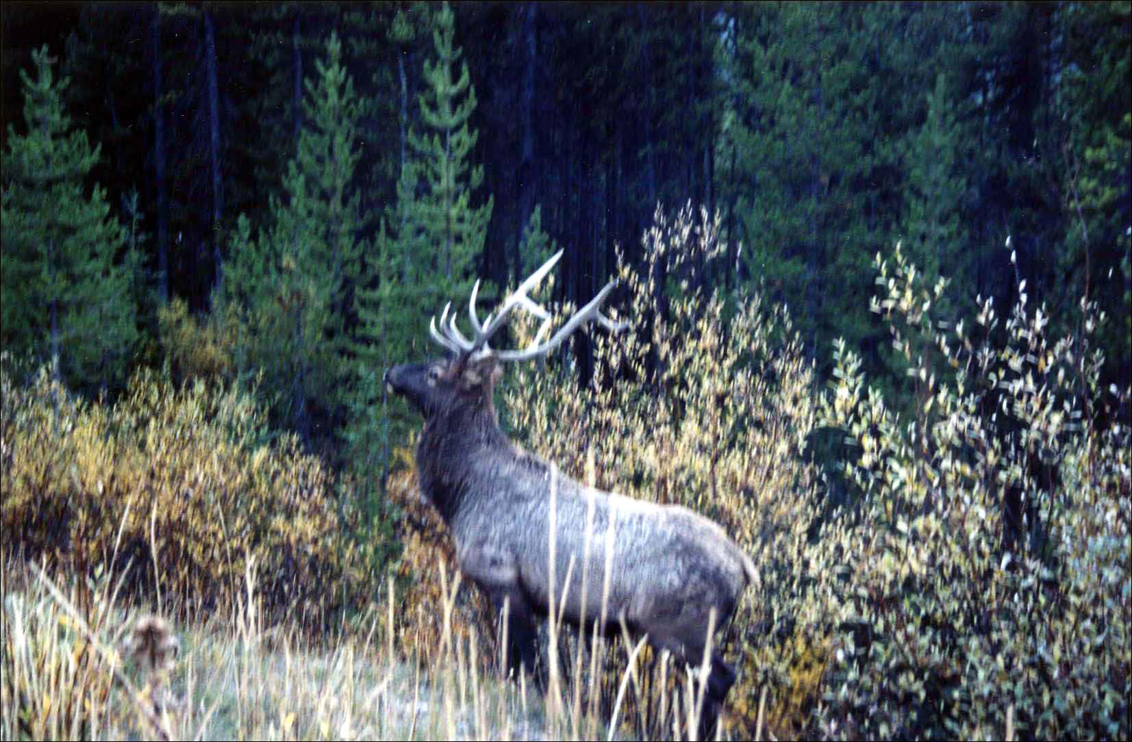 |
Elk |
In the springtime, great herds of caribou migrate from the forest to their summer calving grounds. On the Eastern Shield, the George River herd of Quebec Labrador caribou is one of the largest herds in the world with an estimated 700,000 to 800,000 animals. On the Western Shield, the Bathurst herd of barren ground caribou has about 350,000 animals that summer around Bathurst Inlet. To the west of Hudson Bay, the Qamanirjuaq (Kaminuriak) herd numbers about 500,000 while the Thelon Game Sanctuary is located within the range of the Beverly herd of approximately 300,000 animals.
The arrival of caribou to the Barren Grounds marks the advent of the Central Arctic’s brief summer. It was a time of celebration for local Inuit groups and in years of scarcity, the difference between survival and starvation. Caribou, musk oxen, migratory birds and other creatures are lured by the rich food supply of tundra meadows with low growing sedges, grasses, small wild berries, wildflowers, mosses and lichens as well as the dwarf birches and Arctic willows that grow in river valleys.
The vast tundra region of northern Canada extends beyond the Shield to the Yukon in the west and encompasses the Arctic archipelago. Including portions of Greenland and Alaska, it is the traditional homeland of the Inuit people who have adapted to one of the most adverse conditions on earth. Unable to control the Arctic environment at large, the sophisticated design and manufacture of their clothing created individual micro climates that allowed them to survive in extremely cold weather. It is no fluke that Robert Peary and Ronald Amundsen, attributed with conquering the North and South Poles respectively, both utilized Inuit technology in their endeavors. In spite of copying the design of the parka (Aleut) or anorak (Inuit ‘anoraq’) and advances in synthetic fibers, the modern world has been unable to duplicate the light weight, insulation and wicking qualities of their garments that were made from a variety of skins, furs and feathers. This unique culture was highlighted on April 1, 1999 with the establishment of their new homeland, the Territory of Nunavut, which was formerly the eastern part of the Northwest Territories.The Canadian portion of the great plains of North America is located between the Western Shield and the western mountains. It is an expansive area that gradually rises from the low lying lakes at the edge of the Shield to the foothills of the Richardson, Mackenzie and Rocky Mountain ranges. The southern part is a triangular section of fertile prairie land that is Canada’s major wheat growing belt. Although it is now considered the agrarian heartland of Canada, the earliest settlements were the forts and towns associated with the fur trade.
When Champlain established a fur trading post in 1608 at the site of present day Quebec City, his primary objective was to find a river route to the Pacific. However, this goal was dependent on the success of the fur trading monopoly that had been granted to his employer, the Sieur de Monts. In 1610, with the hope of gaining greater knowledge about the interior and enhancing the monopoly’s trading arrangements, Champlain convinced the Ottawa Algonquins to take some French boys to live with them. It was from this group of young men that emerged the coureurs de bois, men who embraced the freedom and adventure of life in the wilderness.
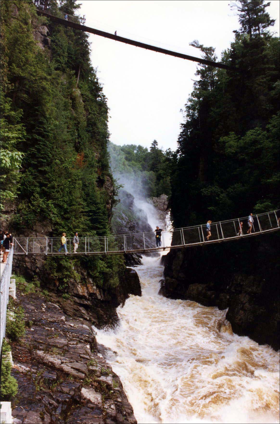 |
Canyon Ste. Anne |
The overhunting and subsequent decline of beavers in the northeast resulted in territorial skirmishes for hunting grounds and control of the waterways that brought furs from the west. These conflicts escalated into the Beaver Wars (1630 -1700) among various tribes and in 1649, the Huron, who were the main suppliers to the French, were defeated by the Iroquois. The subsequent collapse of the French fur trade induced the authorities to liberalize the laws in 1653 to permit the bartering of trade goods for furs by others besides the established chartered monopolies. Seizing the opportunity, coureurs de bois, traders and trappers who already lived among native peoples, extended their activities westward where inland tribes were anxious to acquire European goods. At the same time, the prospect of wealth and adventure lured so many French youth to their ranks that only a year later in 1654, the Governor of New France forbade trading without written consent to leave the colony.
Among these traders/adventurers were Pierre Esprit Radisson and his brother-in-law, Medard Chouart, Sieur des Groseilliers, who were described by the Canadian writer, Grace Lee Nute, as the original ‘Caesars of the Wilderness.’ During the 1650’s, they explored the region around Lakes Michigan and Superior and ventured north from Lake Superior to James Bay. Others followed and a hundred years later, the French had explored as far as the Rocky Mountains to the west and the Gulf of Mexico to the south by way of the Mississippi River Valley.
All of New France was ceded to the English in 1763 but the fur trade continued under the auspices of the independent traders in Montreal. Their hired paddlers became known as ‘voyageurs,’ a term sometimes used synonymously with ‘coureurs de bois.’ Stories of the Canadian Voyageurs are legendary. They were men of great strength, endurance, independence and adventure who were mainly recruited from the large French families and Scottish immigrants. As a group, they epitomized the indomitable spirit on which Canada was founded and they are often remembered for their songs that echoed in the wilderness and established a rhythm for their grueling work.
In 1775, Simon McTavish, a Scottish immigrant, moved from Albany, NY to Montreal with the idea of a joint venture to challenge the Hudson Bay Company’s fur monopoly. Over a hundred years earlier, the Hudson Bay Company was established when the English acted upon Radisson and Groseilliers’ recommendation to set up a trading post on James Bay in 1670. McTavish’s North West partnership was launched in 1790. Whereas the Hudson Bay Company waited for native people to travel to their trading posts, the Nor’Westers actively sought out new sources of fur. Although McTavish and his partners generated enormous profits, the growing overhead of continual expansion drained their working capital and by 1821, they were forced to merge with the Hudson Bay Company. In only 33 years, the Nor’Westers had explored and mapped much of western Canada. It was Sir Alexander Mackenzie, a North West partner, who crossed the northern portion of the continent 13 years before Lewis and Clark’s epic journey, to reach the Pacific. He had discovered the long sought after North West Passage but was disappointed to find that the waterways were impractical for transporting freight across the mountains.
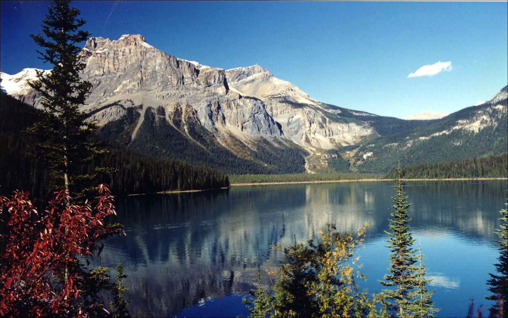 |
Emerald Lake |
The mountains of western Canada are known as the Western Cordillera. They form a continuous backbone that dominates British Columbia and the Yukon Territory with portions extending into the Northwest Territory and Alberta. Topographically, the Cordillera consists of the eastern mountains that rise from the great plains, the western, coastal mountains and the highland plateaus between them. The Rocky Mountains are the highest of the Cordillera’s eastern ranges. Comprised of a myriad of sub-ranges, they are easily accessed and boast some of the most dramatic landscapes in Canada with snow capped peaks, massive glaciers, lush, alpine meadows, roaring waterfalls and crystal-clear glacial lakes. To the west, the St. Elias Mountains run from Alaska through the Yukon Territory to NW British Columbia and are the highest coastal mountains in the world. Canada’s highest peak, Mt. Logan, is found here. The Coast Mountains rise where the St. Elias Mountains end, in an unbroken wall with very few passes. It was journeying through the southern reach of the Canadian portion of these mountains to explore the Fraser River in 1808 that Simon Fraser, another North West fur trader, despaired, ‘We had to pass where no human being should venture.…’ He and his men faced tortuous challenges as they portaged over moss covered outcrops and tenuous footholds along steep precipices where the river was too violent for their flimsy canoes.
Most of Canada’s largest population centers are found in the interior lowlands and portions of the Atlantic provinces. They are connected to the main cities of the other regions by an extensive transportation system of railways, air routes and highways including the impressive Trans-Canada Highway and the transcontinental rail system. Both represent important engineering feats that begin on an island in the Atlantic and end on an island in the Pacific. Canada’s superb transportation infrastructure allows access to the far corners of the country and supports the unique blend of modern conveniences and magnificent wilderness areas.

Adventures Great and Small © copyright 1996-2005