
BATOPILAS CANYON
Just beyond Kirare, the landscape suddenly unfolds to reveal the breathtaking expanse of the Batopilas Canyon. The lure of precious metals attracted the first visitors to this remote canyon but even the most avaricious treasure hunter would have interrupted his hurried journey to contemplate the magnificent panorama. Dizzying switchbacks descend a steep-sided canyon wall for 6,000 ft. (1800m) to a tiny bridge that crosses the silvered snake of the Batopilas River. Directly across the chasm, the Seven Steps rise precipitously toward the heavens. Perhaps it was here that Father Sun and Mother Moon of Tarahumara legend, descended to earth to bless their children.
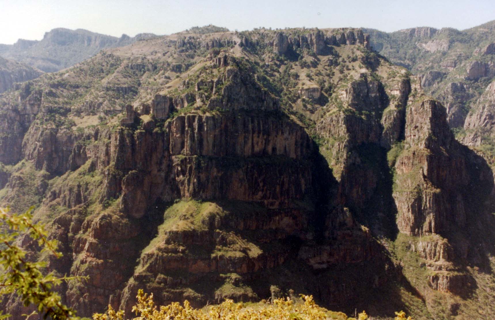 |
Seven Steps |
Accompanying the early miners and settlers were Jesuit missionaries who followed the section of El Camino Real that passed through the Batopilas Canyon. In 1745, the Nuestra Senora de Loreto de Yoquivo Mission was built in Yoquivo, now a small logging community located about 7.5 miles (12 kms.) to the northeast of Batopilas. A circuitous trail passes from Satevo to Yoquivo and then to La Bufa or Batopilas before following the main road by the river back to Satevo. Signs mark the dirt road to Yoquivo from the main road before reaching Batopilas. However, inquiries must be made to locate the trails that lead from La Bufa and Satevo to Yoquivo. Although it is also possible to begin a hike in Yoquivo, transportation between the nearest town, Guachochi and Yoquivo is unreliable and it is difficult to organize a trek from Yoquivo which has few services. Still, the path between Yoquivo and La Bufa is quite scenic and a strenuous option for the determined trekker.
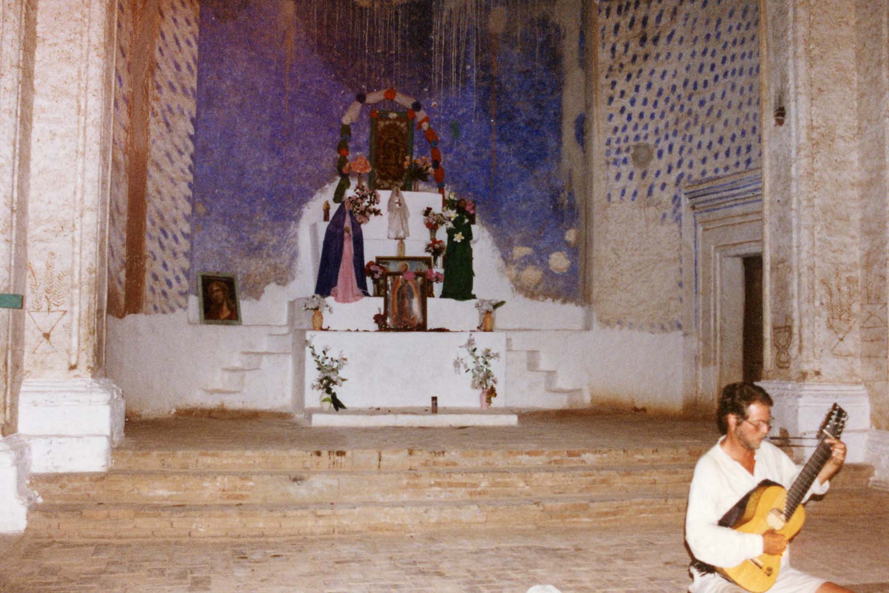 |
Iglesias San Miguel de Satevo |
On closer inspection, the church boasts 3 domes (a large main dome above the sanctuary, a medium sized dome over the library that once connected the church with the monastery, and a small dome above the bell tower) and 4 half domes that have all been plastered except for the bell tower dome. Some of the exterior walls have also been plastered but the original building was built entirely of fired brick and mortar. Bricks were molded, dried and fired on site while calspar taken from the silver mines was burned with river sand to make a durable limestone and sand mortar. Evidence of an oven for this purpose can still be seen to the side of the church. The process required large amounts of water for steam and children passing by carrying their water buckets remind us how little the rhythms of everyday life have changed deep in the barrancas.
Large wooden doors open to expose simple wooden benches on a stark stone floor. Wherever the pavement is uneven marks the presence of graves, some of which are inscribed with names and dates. Locals say that the unmarked grave at the very threshold of the church is that of an unnamed architect who fell to his death while placing the last brick in the church. However, one of the most interesting features of this church is the dominance of statues and portraits of the Virgin on the altar while the image of the Sacred Heart of Jesus sits unobtrusively to the side of the altar rather like an afterthought. The wall behind the altar is painted with blue pigment taken from a nearby copper mine but striated watermarks hint at an ongoing struggle with time and nature. There are other signs of deterioration: faded wall drawings and inscriptions, crumbling brick arches and gaping cracks in the walls. Still, this old mission church stands with a compelling dignity offering the visitor a shaded respite from the scorching sun.
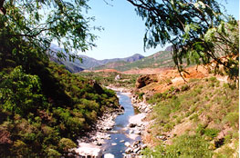 |
Batopilas River Iglesias San Miguel de Satevo in the Distance |
The prolific mines of Batopilas Canyon have been the source of numerous personal fortunes. During the Spanish era, Don Angel Bustamante accumulated enough wealth to purchase a marquisate to become the Marquis de Batopilas. His local residence was the 18th century, La Casa Barffuson, one of the oldest buildings in Batopilas. The War of Independence from Spain brought about the expulsion of many Spaniards and mining production ceased for about 20 years. In the 1840s, Mexican Dona Natividad Ortiz and her associate Nepomuceno Avila reopened some of the closed mines and located several new veins. By the 1860s, the Americans began to arrive in Batopilas, the most notable being Alexander Shepherd, the last governor of Washington DC, who acquired his initial holdings in 1880. Much of Batopilas today reflects the work of this man who was responsible for the construction of most of the existing building and facilities.
The town of Batopilas is unusually placed along a narrow stretch of the river. It is three miles long and confined in width. To the north of Batopilas, a stone aqueduct accompanies the river into town. It was constructed by Shepherd mainly to generate the hydroelectric power needed to light the mines and to operate the foundry that he built to eliminate the expense of shipping raw ore out of the canyon. Today, the aqueduct remains the town's source of water and electricity. It is an easy, pleasant walk along the 3.5 mile trail that follows the aqueduct to the old dam. Once a part of El Camino Real, there are sections where the original stone pavement can still be seen. The path passes some small farms growing fruits and vegetables as well as a few swimming holes in the river that are refreshing when water levels are safe. On arriving at the main bridge into town (also built by Shepherd), it is impossible not to notice the great stone wall that anchors a huge tescalama tree with sinuous roots weaving in and out of the stones. Beyond this wall is the ruin of Shepherd's adobe mansion, the Hacienda San Miguel. It is now densely overgrown with striking purple bougainvillea and a jumble of shrubs and bushes. Instead of using the main bridge to visit the mansion, most visitors like to cross the swaying footbridge providing much amusement to the more agile locals.
 |
Batopilas Canyon |
Some of the best views around Batopilas are found in Yerba Anise and Cerro Colorado, tiny villages high on the mesas above the town. The path to Yerba Anise begins at the trailhead across from the Hacienda San Miguel but continues steeply up the canyon past the turnoff to the Penasquito mine. This is a favorite hike for naturalists because birdlife and wildflowers are plentiful. Cerro Colorado is a small mining community that is about 5 hrs. walk from Batopilas. Some trekkers incorporate the Cerro Colorado hike into a multi-day trek to Urique or to El Tejaban. The trail begins to the north of town at Las Juntas just beyond the old dam. A newly graded road follows the Arroyo Cerro Colorado for about 2 hrs. before the road ascends steeply through oak forests. The little hamlet of Cerro Colorado is located on the mesa in the shadow of the peak bearing the same name. From Cerro Colorado, there are several trails to the town of Urique. The most direct passes up to Yesca and then down to Urique. A longer route follows the ridge between the Batopilas and Urique Canyons before dipping into the Urique Canyon where the trail alongside the river is taken northwards to Urique. These multi-day treks should only be attempted with the assistance of an experienced guide.
Best Times to Go:
Exploring the Batopilas Canyon is best during the dry, cooler
months of November to April. May is already quite hot and summer months bring rain and
humidity. When planning a trip, remember that the rim can be very cold from December to
February.
Getting There:
Buses depart from Creel to Batopilas on Tuesdays, Thursdays and Saturdays and return on Wednesdays, Fridays and Mondays. Hotels in Creel maintain current bus information and can also arrange for private transportation that may be more convenient.
Clothing/Gear:
General Information:
Plan to be incommunicado during a visit to Batopilas. The public telephone does not always work and the postal service is unreliable. Also, there are no banks so travelers should have enough pesos or US dollars on hand for the duration of their visit as cash is required for all transactions.
Planning Tips:
Important Resources:
Sr. Martin Alcaraz Gastelum owns and operates a small, clean hotel near to the main plaza. Eight rooms, seven of which have private bathrooms, are positioned around a gated courtyard. A communal kitchen is provided for the convenience of guests. Meals may be arranged at a nearby restaurant.
Related Books:

Adventures Great and Small © copyright 1996-2005