
|
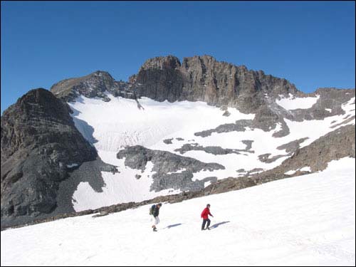
Winter Trekking |
Extensive glacier and water erosion have given these mountains their craggy, rugged look, and they are known for the complexity and power of the streams and rivers which rush down to the lower altitudes. In fact, this range is the third most important glacial region in Turkey following the Agri (Ararat) and Cilo-Sat Mountains. The region enjoys an almost sub-tropical climate of temperature yet rainy weather with an average temperature of 14 degrees C. The lowest temperature falls in the month of January while August sees the hottest days reaching a maximum recorded temperature of 22.6 degrees C.
The Kackars rise between the shores of the Black Sea to the north and the Coruh river valley to the south. On the northern flank an immense variety of vegetation flourishes in the rainy climate. Up to 500 meters above sea level, tea plantations and citrus orchards cover the hillsides. Chestnut, hornbeam, beech and other large-leafed trees forest the slopes to 750 meters. Between elevations of 750-1500 meters, pines mix in with the large-leafed trees until gradually they remain the only species of tree from 1500-2000 meters. Alpine meadows and other grassy vegetation cover the ground above 2100 meters. On the southern faces of the Kackars, which receive strong sunshine and less precipitation, the agriculture is based on the cultivation of fruit and vines. On the northern side, in the higher elevations, meadows of wild flowers and grasses blanket the slopes up to elevations of 2300 meters.
This text is from the mountaineering brochure published by the Ministry of Tourism.
|
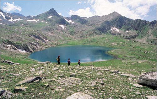
Mountain Lake |
Itinerary
Day 1
Arrive Istanbul, Transfer to hotel.
Day 2
Sightseeing in Istanbul, rest, shopping.
Day 3
Flight Istanbul-Erzurum . Transfer Erzurum --Yusufeli town,Overnight in hotel.Rest and gear check.
Day 4
Transfer to mountain / Hiking to Hevek Plateau,to first camp.
Day 5
Hiking up to Dilberdüzü campsite at 2900m.in the early morning. Camp. Acclimatisation hikes.
Day 6
Hiking up to Deniz lake at 3435m. Summit Day 3937m. (Kackar Mountain)
Day 7
Start Hiking to passage, Lanetleme Hill (3100m.) Camp at Karadeniz Lake (2800m)
Day 8
Trekking to Kara Deniz, Büyük Deniz and Mekerel lake. Rest.
Day 9
Descending down to Asagi Çeymakçur plateau. Transfer to Ayder plateau for natural spring water.
Day 10
Descending down to Ardesen. Flight to Istanbul. Overnight in hotel.
Day 11
Sightseeing in Istanbul, rest, shopping, Entertainment (optional).
Day 12
Departure.
Price:
US$ 975 per person for a minimum group of 4 persons. Individuals may join existing groups but space is limited so your request should be made as early as possible.
Price Includes:
Full Accommodations in Istanbul and Erzurum, Breakfast-Lunch-Dinner
Sightseeing costs (entrance fees and transfers)
Airfares (Istanbul-Erzurum-Istanbul), Transfers (Airport-Hotel-Airport)
Mountain Transfers, English speaking guide
Mountain equipment (Tent, Stove, Mat), Mountain food
Not Included:
Insurance (optional), tax, personal gear, entertainment in Istanbul (optional).
Trip Dates:
Trips can be arranged in July, August and September. Book early to confirm your dates.

© copyright 1996-2005 Adventures Great and Small