
SIERRA TARAHUMARA, (COPPER CANYON), MEXICO
Beautiful lily, in bloom this morning, guard me.
Drive away sorcery. Make me grow old.
Let me reach the age at which I have to take up a walking stick.
I thank you for exhaling your fragrance there, where you are standing.
A Tarahumara Prayer
Darkness comes quickly to the rugged canyon lands of the Sierra Madre where stars twinkle exuberantly against the blackness of a night sky unencumbered by ambient light. As the moon makes her journey across the heavens, the sounds of distant drumbeats race across the high sierras echoing their message throughout the canyons. This is Tarahumara-land where drumbeats tell of dancing and the dance is a Tarahumara prayer. In recent years, most of their prayers have been for rain but the Raramuri (also known as the Tarahumara), who have preserved their culture better than other native American groups, also dance to give thanks for their blessings.
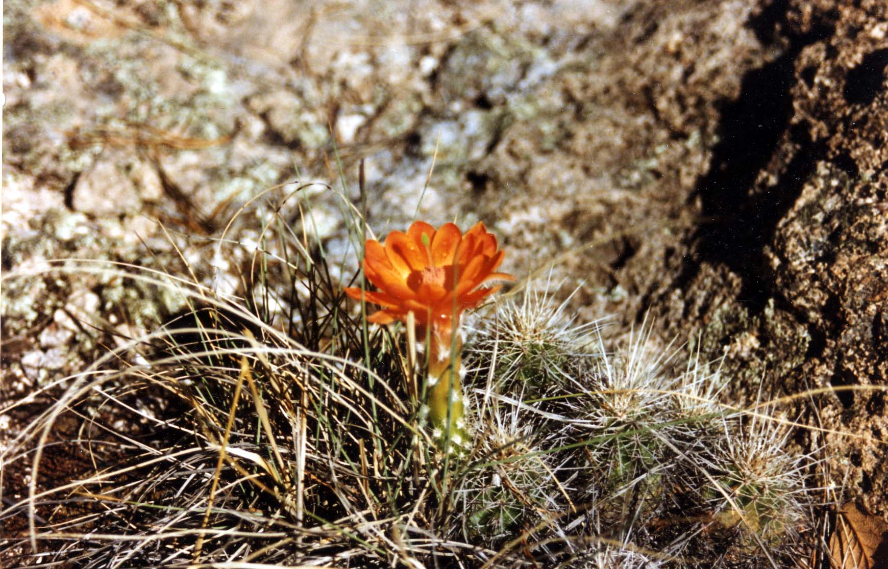 |
Echinocereus triglochidiatus |
The discovery of precious metals in the region early in the 17th century brought Spanish miners and settlers who enslaved the Raramuri to work the mines and fields and to transport their goods across terrain that was too rough even for horses. To escape the forced labor, the Raramuri retreated deeper into the remote sierra and canyon country now known as the Sierra Tarahumara. Here, they live in small, scattered communities. Their ranchos or communal farms are usually found along wide sections of rivers and streams but can sometimes be seen perched on the slope of a precipitous cliff. Deprived of their productive lands, the Raramuri keep herds of sheep, goats and cattle mainly to produce the manure needed to farm the shallow soils of the barrancas as well as for food. Their homes are simple huts but some of the more reclusive Raramuri still live in caves, migrating to the barrancas (bottom of the canyons) in winter and to the sierras (plateau and mountain areas) in the summer.
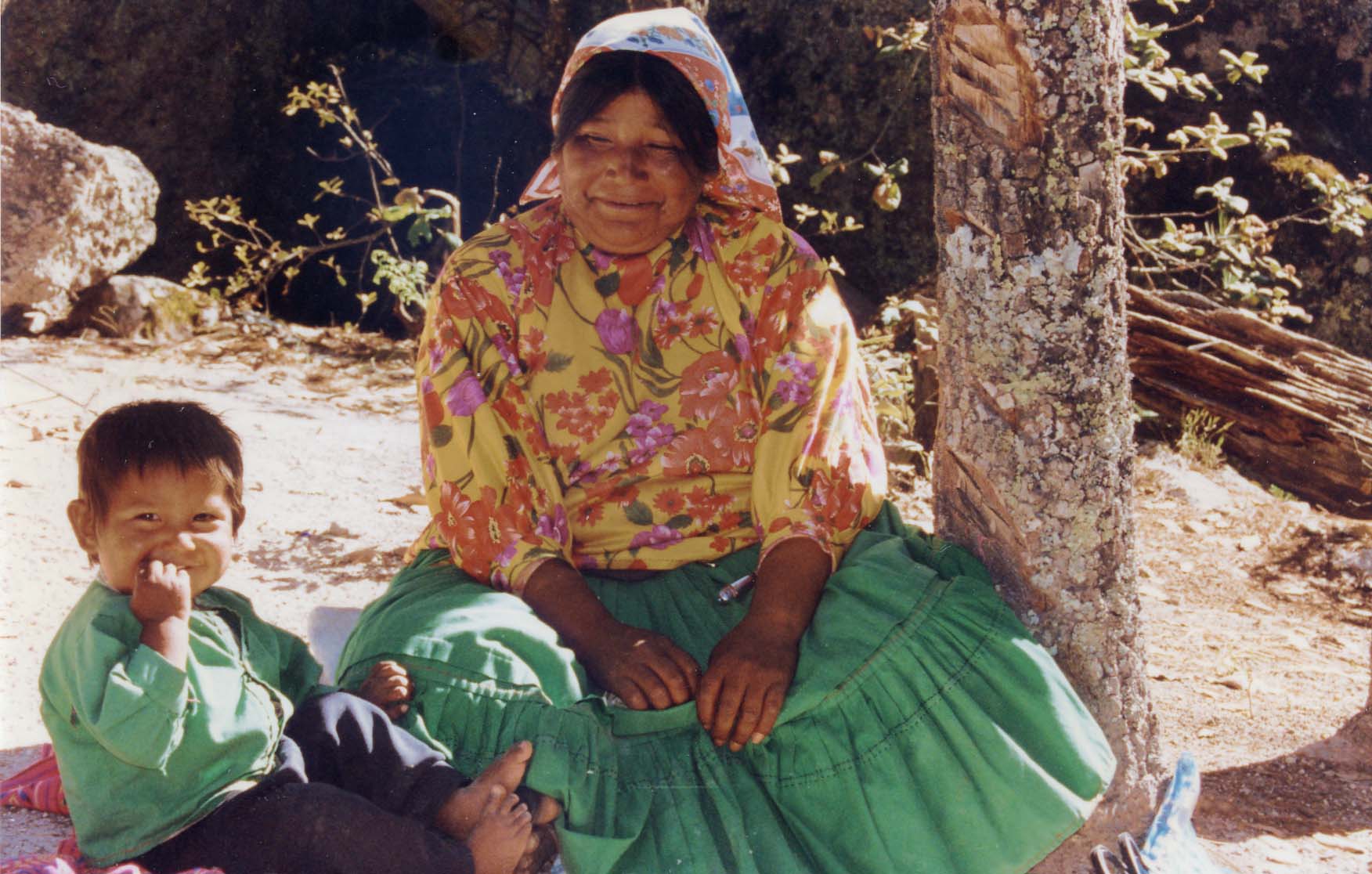 |
Mother and Child |
Prior to the Raramuri, the Paquime civilization dominated the northern portion of these remote canyon lands. They were farmers and traders who established themselves strategically at the juncture of the rivers that flow to the Gulf of California and the River Conchos that joins the Rio Bravo del Norte (also known as the Rio Grande) to empty into the Gulf of Mexico thus controlling the ancient trade route linking the eastern and western shores of Mexico. The main archaeological site located near Casas Grande is the great city of Paquime whose construction began around 1200 and reached its prominence as a trade and ceremonial center in the 14th century when it was destroyed and abandoned. Other remnants of the Paquime civilization include adobe cave structures that are estimated to be about 800 to 1000 years old. They may have served as guard posts to maintain and protect these old trade routes and some can still be seen in the cliffs overlooking the Huapoca Canyon.
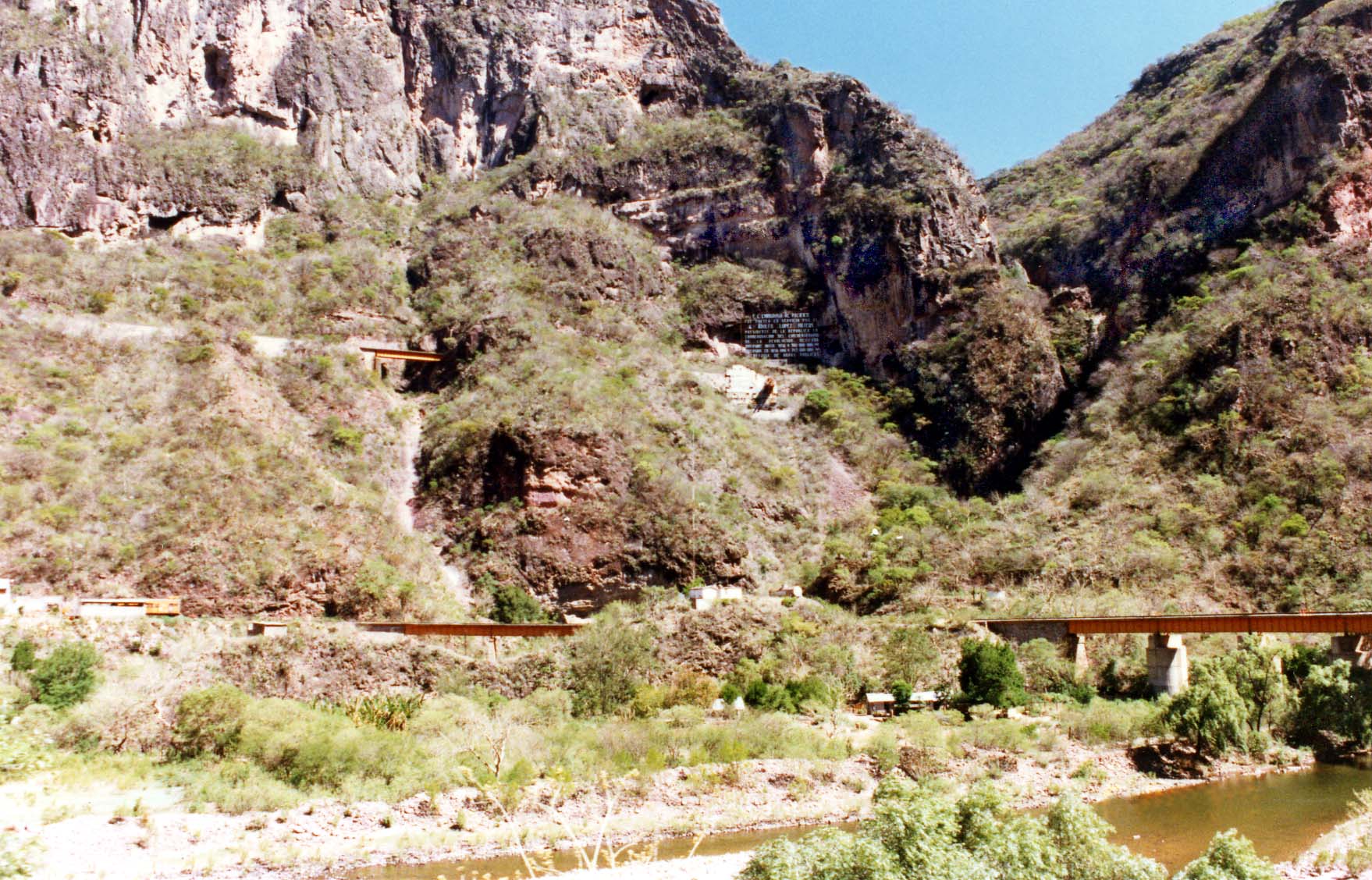 |
Two Levels of Track Temoris Station |
Although the 'Barranca del Cobre' is a canyon along one section of the Urique River, the name has come to be associated with the entire canyon system of the Sierra Tarahumara that comprises more than 20 canyons of which 5 are longer and deeper than the Grand Canyon in Arizona, USA. Millions of years ago, tertiary volcanoes deposited their ash to form massive plateaus from the mountains of the region. Later volcanic activity created gaping cracks that were eroded by rain and subterranean water resulting in a wild, divided land that is among the most rugged in North America. Within this extensive canyon system, rivers are rendered unnavigable by great boulder fields and some of the highest waterfalls in the world.
Mile deep canyons have starkly different environments on the sierras and inside the barrancas. On the high plateaus and canyon rims with altitudes over 8000 ft. (2400 m), the climate is temperate (cold winters, mild summers) with heavy summer rains. Beautiful, fragrant, coniferous forests of pine and Douglas fir cover these highlands where the black bear, puma, Mexican wolf and mountain lion live in the more remote regions. These animals are rarely seen and are threatened with extinction in the Sierra Tarahumara. Summer rains herald verdant mesa tops that are gaily colored with wildflowers from the end of September to October. At lower levels, 6000 to 8000 ft. (1800-2400m), other species of pines, junipers, and numerous oaks occupy the expansive forests while shade- tolerant Madrona trees grow in their understory presenting a striking contrast with their smooth, red-colored bark. Around Basaseachi and Madera, alders and poplars add blazing color to the forests in the fall. These woodlands give way to brushwood and scrubby trees on canyon slopes below the rim between 4000 to 6000 ft. (1200-1800m). Many have adapted to arid conditions by dropping their leaves during long, dry spells. At the bottom of the canyons, tropical conditions prevail and where water is available, huge fig and ceiba trees can be found as well as a variety of
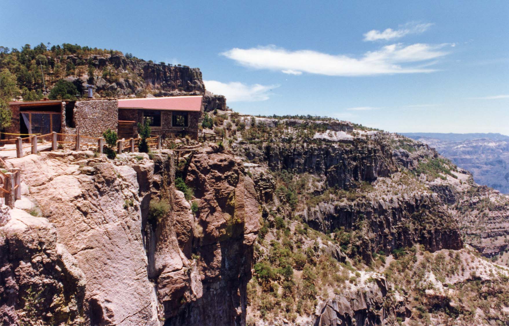 |
El Divisadero |
The early explorers of Mexico were commissioned to explore and secure new lands for the Spanish Crown. Lured by tales of great wealth, they combed the country of its treasures by plundering native tribes and locating almost all of the precious metals that had cropped out of the ground. Expeditions were organized and new settlements established at the expense of the explorer who hoped to recoup his investment by finding new mines or capturing fertile lands. Soldiers were recruited with the promise of encomiendas which were grants for the employment of native people who were supposed to have been paid for their services, protected and 'civilized' by conversion to the True Faith. Missionary priests accompanied the expeditions for this purpose.
Large silver deposits were found to the north of Mexico City in Zacatecas in 1540 encouraging further exploration of the northern territories. Francisco de Ibarra and members of his expedition to Paquime in 1565 were probably the first Europeans to penetrate the Sierra Tarahumara. Later, Gaspar Osorio reached Chinipas (southwestern region of the Sierra Tarahumara) in 1589 and by 1590, silver had been discovered in the canyon lands. Prospectors arrived along with priests who established several missions. Under the guidance of the Padres, mission churches, schools and other buildings were constructed but some of the early 17th century structures were razed when the Tarahumara and other tribes revolted against their enslavement and the devastating effects of European diseases that greatly reduced their numbers.
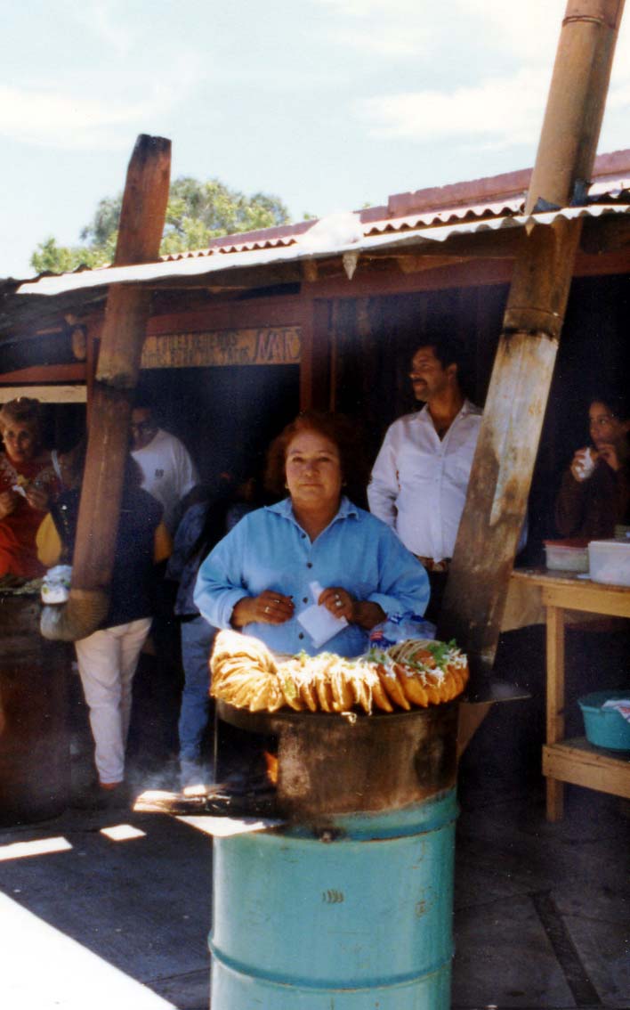 |
Gorditas El Divisadero |
Specific information about the major canyon systems of the Sierra Tarahumara is outside the scope of this page but will be added over time. The main canyons are:
1. Urique Canyon and Copper Canyon with adjoining Cusarare and
Tararecua Canyons
2. Batopilas
Canyon
3. Huapoca Canyon
4. Candamena Canyon
5. Oteros Canyon with adjoining Chinipas and Septentrion Canyons
6. Sinforosa Canyon
Best Times To Go:
Summer months inside the canyons can be uncomfortably hot, especially in May and June. The rainy season from July to September brings some relief from the heat. The canyons are considerably warmer than the surrounding rims so March to April and late Septembers to October offer visitors the best balance of comfortable weather inside the canyons and on the rims.
Getting There:
Los Mochis is reached by air or by bus from major Mexican cities that include Mexico City, Hermosilla and Chihuahua. There are direct flights from Los Angeles and Tucson in the US. The Sematur ferry provides service to the nearby port town of Topolobampo from La Paz in Baja California while the excellent Coastal Highway 15 connects Los Mochis to Hermosillo and Nogales in the north and Mazatlan and Guadalajara in the south.
Chihuahua may be accessed directly by air from the US via Fort Lauderdale, Los Angeles, Dallas-Fort Worth, Tucson and El Paso as well as from major Mexican cities that include Mexico City, Ciudad Juarez and Hermosillo. Bus service is available from most Mexican cities. From the US, buses leave hourly from the Greyhound bus station in El Paso and cross the border to Ciudad Juarez where regular expreso buses depart to Chihuahua. Highway 45 is the main road between Ciudad Juarez and Chihuahua.
Creel is the most popular base for exploring the canyons. It may be reached by train from Los Mochis or Chihuahua. There is also a daily local bus service from Chihuahua.
Clothing/Gear:
General Information:
The easiest way to explore the canyon area is to take day trips from a specific base. Creel offers the best tourist infrastructure and the most variety of day tours. It is a good base for visits to the Copper, Cusarare and Tararecua Canyons. Cerocahui is convenient for accessing the Urique Canyon. Batopilas Canyon is best explored from Batopilas although accommodation options are somewhat limited. Madera is a large, modern town with basic tourist facilities and is a convenient base for visiting the Huapoca Canyon. Although rooms are available near to Candamena Canyon and the Basaseachi area, Creel or Tomochi are the nearest towns with reliable tourist services. The Sinforosa Canyon, Oteros Canyon and its adjoining Chinipas and Septentrion Canyons are remote and difficult to access. Insufficient roads and drug cultivators contribute to the inadvisability of visiting these areas alone without appropriate arrangements.
Day tours and hiking trips are easily arranged at any local hotel. Taxi drivers also make excellent guides and offer more flexibility than the hotel tours. Other than day hiking trips, any exploration of the canyon lands will require advanced backcountry skills even when accompanied by a guide. There are no manicured trails with signposts or rangers looking for lost souls. Maps may be confusing or inaccurate. Trails are more apt to lead from pasture to pasture rather than from village to village and shelters are the rocky overhangs and caves used by the Raramuri. There are no provisions available except in the main towns so all food and water must be carried in. This type of trip is best done with a group. For those who want to put together their own expedition, the local hotel will help to hire a burro and guide. A good knowledge of Spanish is helpful as it is unlikely that the guide will speak English.
Planning Tips:
Important Resources:
There are several luxurious Balderrama hotels in towns along the Copper Canyon Railway. The Balderrama Posada Barrancas Mirador is particularly notable because it sits on the edge of a cliff overlooking one of the most spectacular views of the Copper Canyon. Some of the best values in Copper Canyon tour packages are available through Viajes Flamingo and include train tickets, transfers and luxurious hotel accommodations.
Related Books:

Adventures Great and Small © copyright 1996-2005